|
|
|
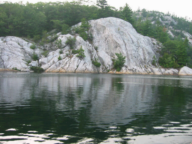
| A pothole complex, consisting
of a series of partial potholes and a complete pothole, occurs in the side
of a quartzite cliff at the western end of George Lake, in Killarney
Provincial Park, Ontario. The complete pothole is located at the site of
the small maple tree at the centre of the photo, immediately behind the
swimming beaver. The pothole is about 2 m in diameter and of unknown depth,
and contains some large rounded boulders. A series of partial potholes
extends above and to the left of the pothole, to the top of the cliff. The
pothole complex occurs on the lee side of a quartzite knob that was swept
by currents flowing towards the southwest, which is towards the left in the
photo. |
|
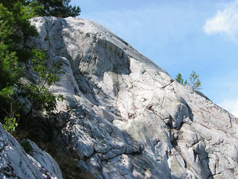
| The upper section of the cliff contains a large partial
pothole. |
|
|
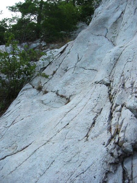
| The photo shows a smaller partial
pothole, about halfway up the cliff. |
|
|
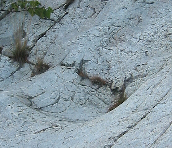
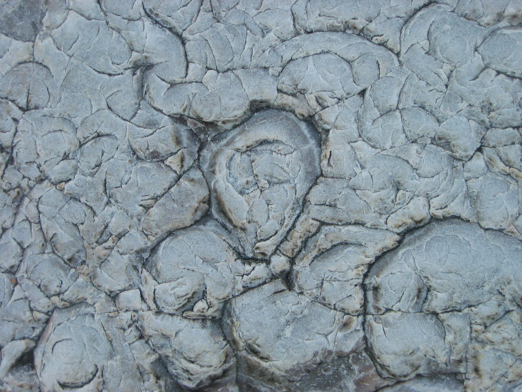
| Detail of the rock surface near
the base of the partial pothole shown in the previous photo, showing
crescentic and circular marks in the rock surface. The crescentic marks
are common in the quartzite rock along the northern shore of the lake.
It is suggested they are relics of the disintegration process that caused
the potholes during former catastrophic conditions. The crescentic marks
represent "interrupted" pebbles and boulders that were in the process
of being produced as the rock disintegrated. |
|
|
| The photo above shows details of
the surface texture of the quartzite at the site of the potholes. The rock
surface was apparently in the process of disintegration, forming pebbles,
resulting in potholes containing sand, boulders and pebbles, and the process
was arrested. The erosion of the lake basin was easily accomplished by fast
currents which removed the products of the disintegration. Loaded with this
debris, the currents streamlined the exposed rock surfaces they impacted,
and pebbles and boulders striated and grooved the streamlined rocks as they
were swep away. |
|
|
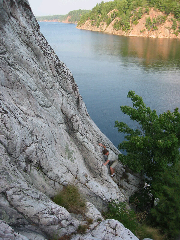
| The complete pothole and maple
tree are at the lower right, below the climber. The rock in the foreground
is quartzite. In the background is George Lake, which occupies a rock basin
that was eroded by catastrophic currents flowing from the northeast to the
southwest. Granite forms the opposite shore of the lake. The pothole complex
is located on the lee side of the rock outcrop that was swept by the fast
currents that eroded the lake basin. Pressure release during the excavation
of the rock basin by the currents initiated in situ disintegration,
causing the potholes. Disintegration also aided the erosion of the rock basin
of George Lake, along with other similar lake basins in the region. Disintegrated
material including pebbles and boulders was removed by the rapid currents.
The currents were generated by uplift of parts of the Canadian Shield,
when it was submerged. |
|
|
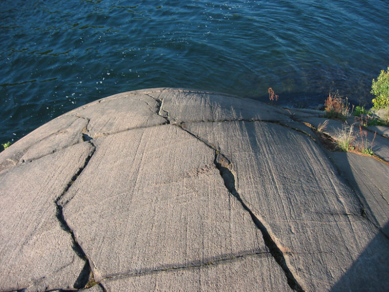
| Streamlined rocks occur along
the shores of George Lake, along with striations and grooves caused by
the pebbles and boulders swept along as the lake basin was excavated by
fast currents that flowed towards the southwest. This photo shows
a streamlined granite surface with striations, at the eastern end of George
Lake. Striations probably obscured crescent shaped markings caused by rock
disintegration in many areas. |
|
|
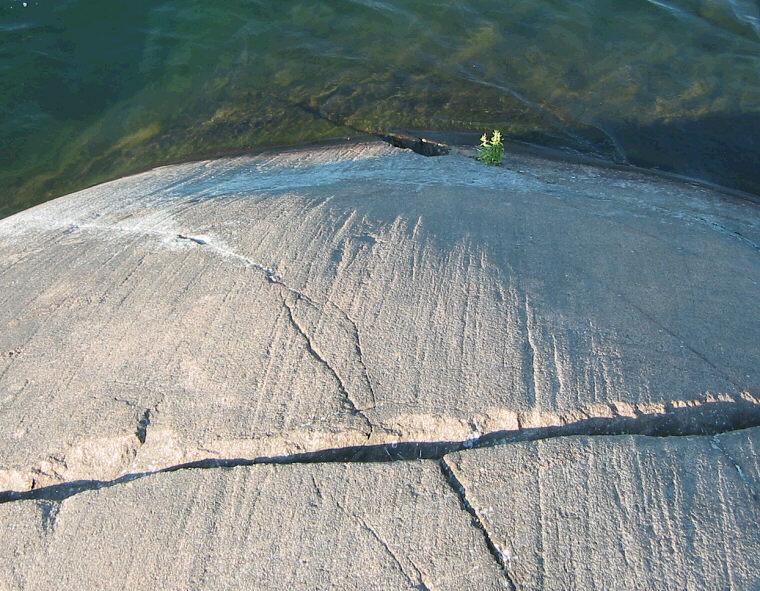
| Another view at the same location as the
previous photo, showing striations on the upstream side of the streamlined
rock. Current flow was from northeast to southwest (towards the viewer). |