A submerged ridge running southwest from Rondeau and Pte. au Pins on the Ontario shore may be a remnant of the western end of a smaller basin; Point Pelee and the submerged Lorain Ridge may also be eroded remnants of a former western end of the Lake Erie basin, that was breached by the currents. Or, perhaps the various basins formed simultaneously and became interconnected as they became enlarged by the action of the currents.
Possible stoss and lee features occur near the islands at the western end of the lake; the lee-side ridge west of Kelleys Island is consistent with powerful currents that flowed towards the west-southwest. Holcombe et al investigated this region and found overdeepened channels due to wind-driven circulation through restricted passages. They wrote [Holcombe, 1997]:
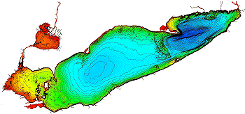
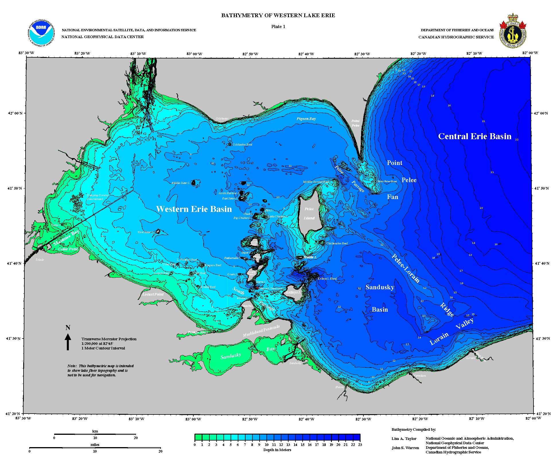
The islands and reefs bordering and lying within the western basin have bedrock cores which are erosional remnants of the more resistant upper Silurian and lower Devonian dolomites and limestones. Overdeepened channels between the islands have been sites of postglacial nondeposition, and probably erosion, due to intense wind-driven water circulation through these restricted passages. The Pelee-Lorain Ridge is interpreted as a late Wisconsinan end moraine upon which sand deposits have been concentrated.Currents which eroded the basin of Lake Erie were probably similar to the ones that excavated Lake Ontario. At Kelleys Island, near the western end of Lake Erie, the bedrock is deeply grooved which suggests it was not fully consolidated during the events which excavated the lake basins. Pictures of the grooves can be found here.
![]() See
Map
for the location of Kelleys Island.
See
Map
for the location of Kelleys Island.
Lewis, C.F.M. et al. 1996. Were the Ontario and Erie basins swept by
catastrophic meltwater flooding? Geological Society of America
Abstracts with Programs. 28 (3):76.
New Bathymetry for Lake Erie and Lake Saint Clair |
 |
© 1999 by Douglas E. Cox
The Creation Concept